



Mat-Su Borough to Collect Aerial Imagery
The Mat-Su Borough will be collecting aerial imagery over the next three years. In the recurring program, data will be collected over various areas of the Borough each year. Area
The Mat-Su Borough will be collecting aerial imagery over the next three years.
In the recurring program, data will be collected over various areas of the Borough each year. Area 1, spanning along the Parks Highway from the Willow area to north of Trapper Creek, will be collected this year. Areas 2 and 3, collected 2023 though 2025 will run south to Point Mackenzie Road and to east of Eureka.
Mat-Su Borough GIS Specialist and Project Manager Nick Srebernak says that more densely populated areas will get more resolution. Talkeetna and Willow areas will get six-inch data resolution, while the remainder of the area will get a mix of six-inch and one-foot resolution.
Srebernak notes that the department reaches out to the various other Borough departments to determine needs, which will help direct where aerial imagery is collected. When asked how the data would be used, Srebernak notes that the data can be used by any department, including code compliance, to keep the 911 database up-to-date, and to update parcel lines. Acting ID Director Leah Jones says the data has a lot of internal and external uses.
“We also use it pretty heavily when the Borough has any type of emergency operations center, situational awareness of where things are at. And, of course, being government, it is used for anybody in the public. We put it on our parcel viewer and that’s used heavily by developers, real estate, and just general public looking at what’s been done in the area, researching properties, that kind of stuff.”
Jones also notes that the recurring imagery can be useful for showing how land has changed over time. Landowners can use the slider to see what their property looked like a few years ago compared to the most recent images. The imagery also shows wildfire damage and helps to prepare for upcoming wildfire seasons, as well as showing how the rivers change over time.
The imagery will be available on the Borough website once it is processed. Data from 2011 through 2022 is available for various parts of the Borough at this time.
Read More
Su Valley Voice for October 15, 2026: Government Check-In
This week on Su Valley Voice, host Phillip Manning shared pre-recorded interviews with two candidates and shared information about the November 3 election.

Bean-A-Fit Dishes Out Almost Four Decades of Philanthropy
The Talkeetna Bean-A-Fit Crew has been dishing out soup at a community meal for almost 40

Talkeetna Local Takes on National Karaoke Competition
Singer-songwriter Kayti Heller, who performs as Aspenyarrow, hadn’t considered karaoke as a part of her professional
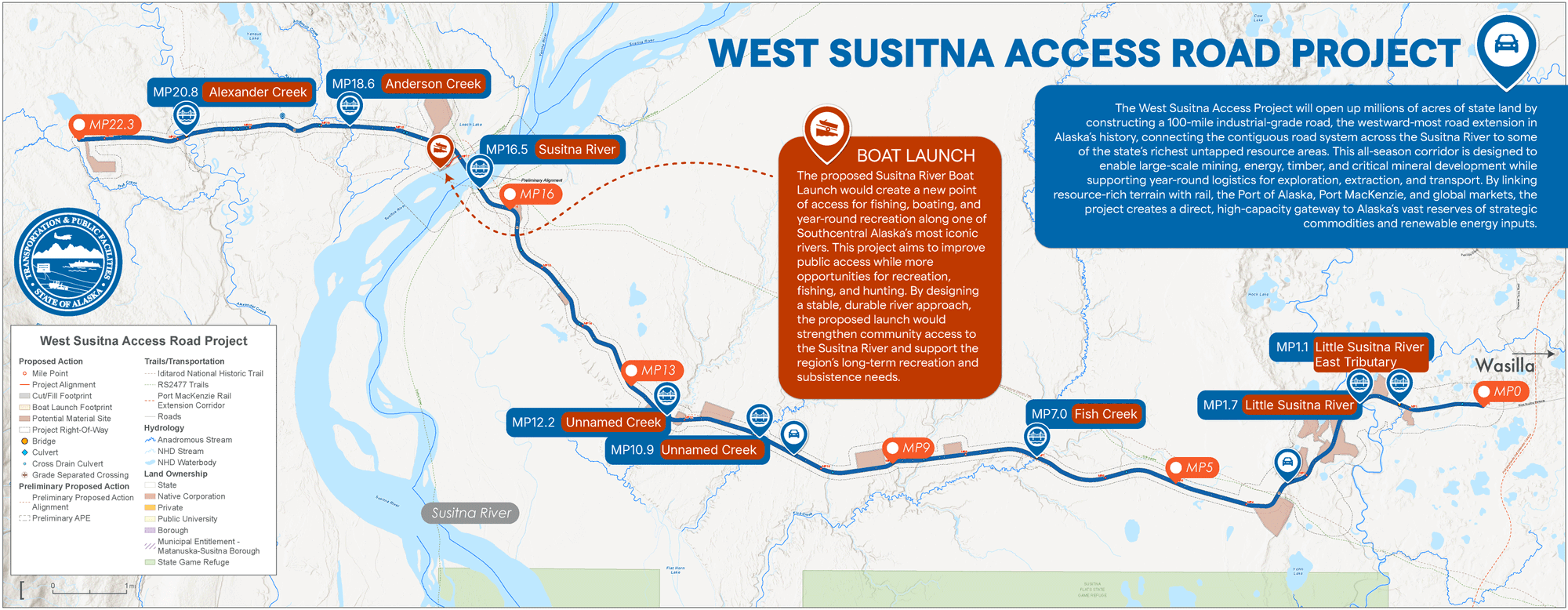
West Su Access Road on Permitting Fast Track
The West Susitna Access Road is now on a fast track for permitting approval.